Strange Maps

White text on a light gray background reads "Strange Maps" in a large, decorative font.
The world, seen sideways

Most maps show the world as something to be navigated. Strange Maps reveals the worlds humans have imagined.

Since 2006, Frank Jacobs has been collecting and interpreting maps that do more than chart geography or political borders. These maps — often obscure, beautiful, funny, and deeply revealing — each tell a story, usually one that’s more about how we see ourselves than where we are.

Published as a book in 2009 and a Big Think column since 2010, Strange Maps draws on a steady stream of reader submissions and rare discoveries. Together, they offer a way of seeing the world from unfamiliar angles, where cartography becomes culture, argument, and art.

with

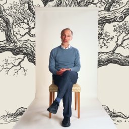
Frank Jacobs is a journalist whose work explores how culture, history, and imagination shape the way we see the world.

Full Profile
strange maps
“The Chinese Job”: Spain’s wild 1580s plan to conquer the world — via Beijing
The plan — conquer China and push west to attack the Ottomans — was peak imperial hubris, as the Spanish themselves eventually realized.

Frank Jacobs

A color-coded map of Asia shows four migration phases from China, with arrows pointing toward Papua New Guinea and the Andaman Islands, both circled in yellow.
A graphical representation of network connections superimposed on a dark map, highlighting major nodes with bright orange and yellow lines.
Digital analyses of Enlightenment-era letters are teaching us a thing or two about Locke, Voltaire, and others.
A composite image of the milky way galaxy showing colorful interstellar dust and gas with star fields.
This first-of-its-kind image offers a detailed look at the magnetic fields within the Central Molecular Zone.
Do you live in a new desert?.
Most counties in the U.S. have only one local newspaper, often one that publishes weekly instead of daily.
Map of the united states indicating earthquake epicenters and areas where people reported feeling at least weak shaking, highlighting a magnitude 6.0 earthquake in central california on september 28, 2004, and a magnitude 5.8 earthquake in central virginia on august 23, 2011.
Across the subterranean United States, not all rocks were created equally.
This map samples some of the digits that make up the DDC system, invented by the brilliant but flawed Melvil Dewey.
Historical map illustration depicting a planned city layout with a circular central area and radiating streets.
A small Ohio town tried to escape America’s addiction to rectangular grids. It didn’t last long.
A map showing the route of a voyage from sweden to norway.
The Trojan War was fought in Finland and Ulysses sailed home to Denmark, says one controversial theory.
A map of antarctica with the word west antarctica.
The Antarctic Treaty of 1959 prohibited nations from making new land claims on the continent. But it never mentioned claims from private individuals.
A map with a circle and a circle in the middle.
The $21.5-billion project could involve tunneling hundreds of feet under Lake Geneva.
A graph showing the death rate on everest.
The world’s highest mountain is also the world’s highest cemetery, with some bodies serving as creepy landmarks for today’s climbers.
A map showing the location of the arctic sea.
No shots fired. No flags raised. And no dry land gained. Still, the U.S. effectively grew by the size of about two Californias in December.
A map of europe with many orange dots.
London’s busiest airport seems to be rebounding well from the pandemic — but Istanbul has better prospects in the long run.
derinkuyu
A basement renovation project led to the archaeological discovery of a lifetime: the Derinkuyu Underground City, which housed 20,000 people.
A map of europe with pink dots on it.
Thanks to protocols established centuries ago in Europe, world leaders no longer need to worry about having their heads bashed with an axe.
If you find yourself on one of these roads, it might be a while before you see another fellow traveler.
A map of the world with a circle around it.
To this day, one cult believes that Lemuria was real, and that its people left us the sacred wisdom to revive their advanced civilization.
A map showing the location of the arctic ocean.
If we're going to discuss oceanography and climate change, we should at least identify the currents correctly.