


A geography column on history and society.
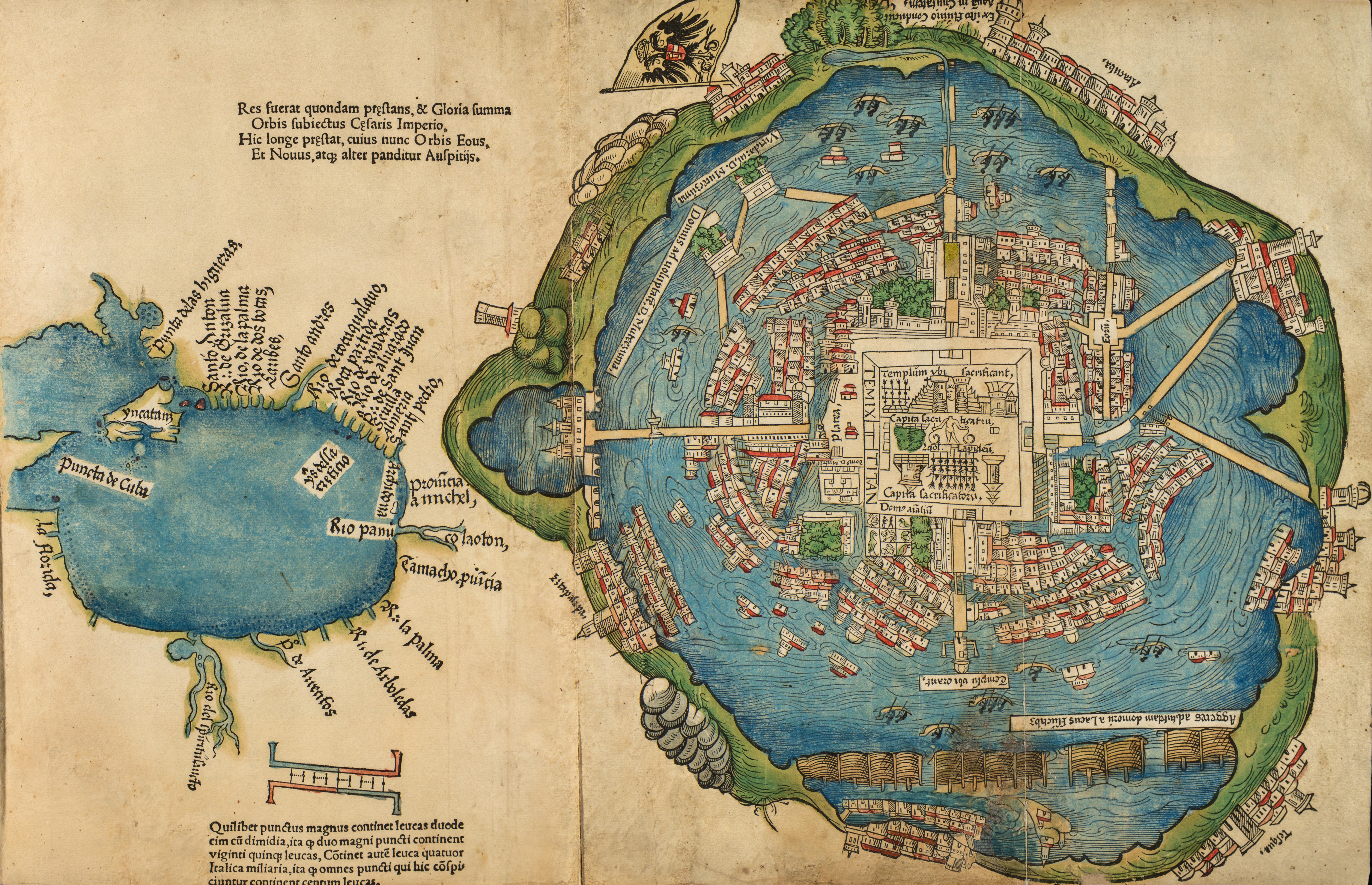
For early 16th-century Europeans, this map was a revelation. It showed a previously unknown island metropolis in the recently discovered Americas — an alien Venice, if you will.
However, by the time this first European portrait of the Aztec capital Tenochtitlan was published in 1524, the city, once home to perhaps 200,000 people, was already gone — razed in 1521 by Spanish conquistador Hernán Cortés. In its place, Mexico City would eventually rise.
Yet this is more than the ghost map of a recently deceased city. It is a multi-layered document of first contact, evidence of the hybridization of two clashing cultures as well as the dominance of one over the other.
Curiously, nobody knows who exactly made this map. The leading theory is that it was based on an indigenous chart of the city. Cortés had obtained from the Aztec emperor Montezuma a map of the coastline, so it seems plausible that a native cartographer provided a cartographic outline of the capital, too.

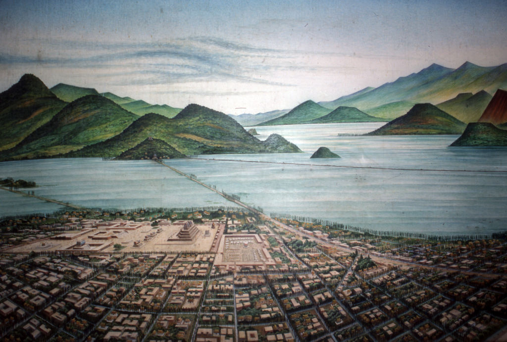
The map shows a city labelled Temixtitan built on islands in Lake Texcoco. Four causeways in the cardinal directions connect the mainland to a central plaza, which contains two sacrificial temples.
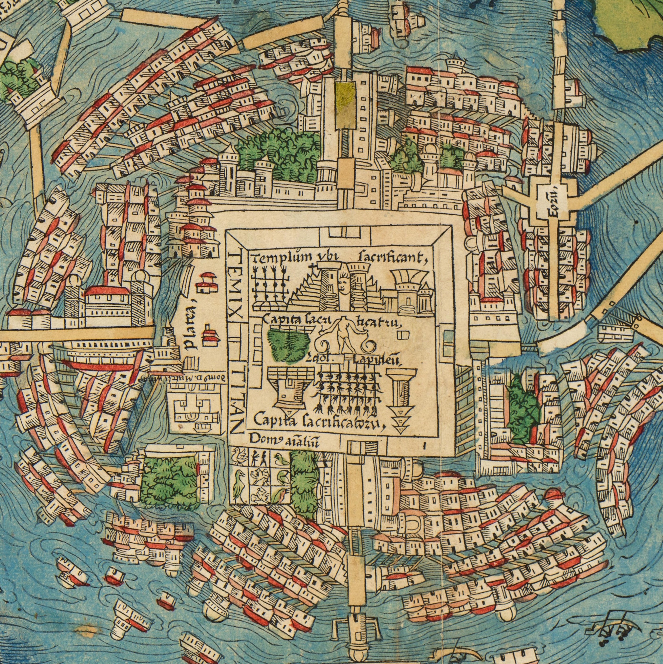
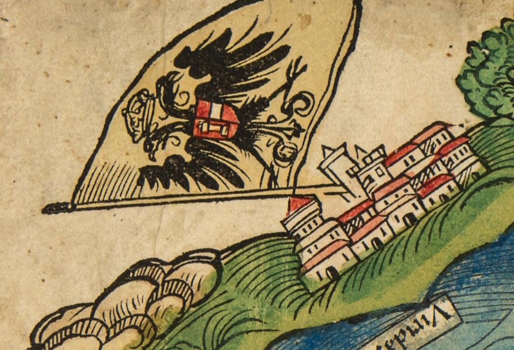
The map is oriented toward the Aztecs’ cosmological prime direction: south. To the left is the Caribbean shoreline, with the first mention in a European document of the name Yucatan.
While those elements point to local knowledge, the houses are rendered in a Europeanized style, with turreted buildings as European shorthand for “this is a city.” This suggests the original cartographic information was interpreted by a woodblock cutter in Nuremberg, where the map was printed.
The map thus occupies a fascinating intercultural space: likely grounded in indigenous cartography, translated via Spanish descriptions into a woodblock print in the German tradition. At each stage, the portrait lost something, but in the process, gained a clear indication of whose purpose the map served.
The map illustrated a letter by Cortés, currying favor with the Habsburg Emperor Charles the Fifth. It reinforced the message that Habsburg Spain had discovered and subjugated a civilization of dazzling magnificence and wealth, thereby cementing its primacy over other European nations.
The map was copied and recopied across Europe, making it the authoritative Old World vision for generations of a New World megacity that no longer existed. The map, as a window into an exotic otherworld and a symbol of Habsburg might, had become an independent reality, even though Tenochtitlan itself had been reduced to rubble — or rather precisely because of it.
What had happened to the Aztec capital was more than a tragedy. It was a template for the three following centuries of Europe’s incursion into the Americas, which can be summarized as: see, name, map, claim, erase.
The act of mapping is never neutral. Aztec cartography, as in the Codex Mendoza (around 1542), shows a cactus growing from a rock at the centre of Tenochtitlan, a visualization of what the city’s name means (“place where the cactus grows on a rock,” in Nahuatl).
European maps replaced this symbolic cosmology with the dispassionate diagram of the surveyor, more suited to conquest. That included reducing the complex spatial and political geographies of native societies to blank spaces, awaiting a European re-reading of the land. To be unmapped was to be unclaimed — and to be mapped was to be already half-conquered. You could call it erasure through documentation. Or, the map as a menu for land-hungry empires.
What if we ever end up on someone else’s menu? Imagine some exocivilization watching us right now, mapping Earth’s emissions and transmissions. What would they see, what would they miss?
They would definitely be like that German woodcutter, mapping us after their own conventions. Perhaps they would group us by the chemical traces of our agriculture and industry, by our thermal output, or by our electromagnetic signatures. Most likely not by our languages, borders, or religions, which would probably mean very little to them.
Their map of Earth might carry a strange beauty, like the 1524 map of Tenochtitlan, and perhaps a dark premonition. If they published their map with a few decades’ delay — due to interstellar travel and all that — what would remain of what they had recorded? Any map of the Earth today is in effect already a snapshot of a world in rapid degradation. It might be unrecognizable in a generation or two. Today’s map of Earth would be a ghost map for tomorrow’s aliens. We, however, won’t have a Cortés to blame for it.
Strange Maps #1288
Got a strange map? Let me know at strangemaps@gmail.com.

The Energy Transition